Thousands of maps on Google Maps
Our main tool and reference application for quickly consulting all types of geographic information.
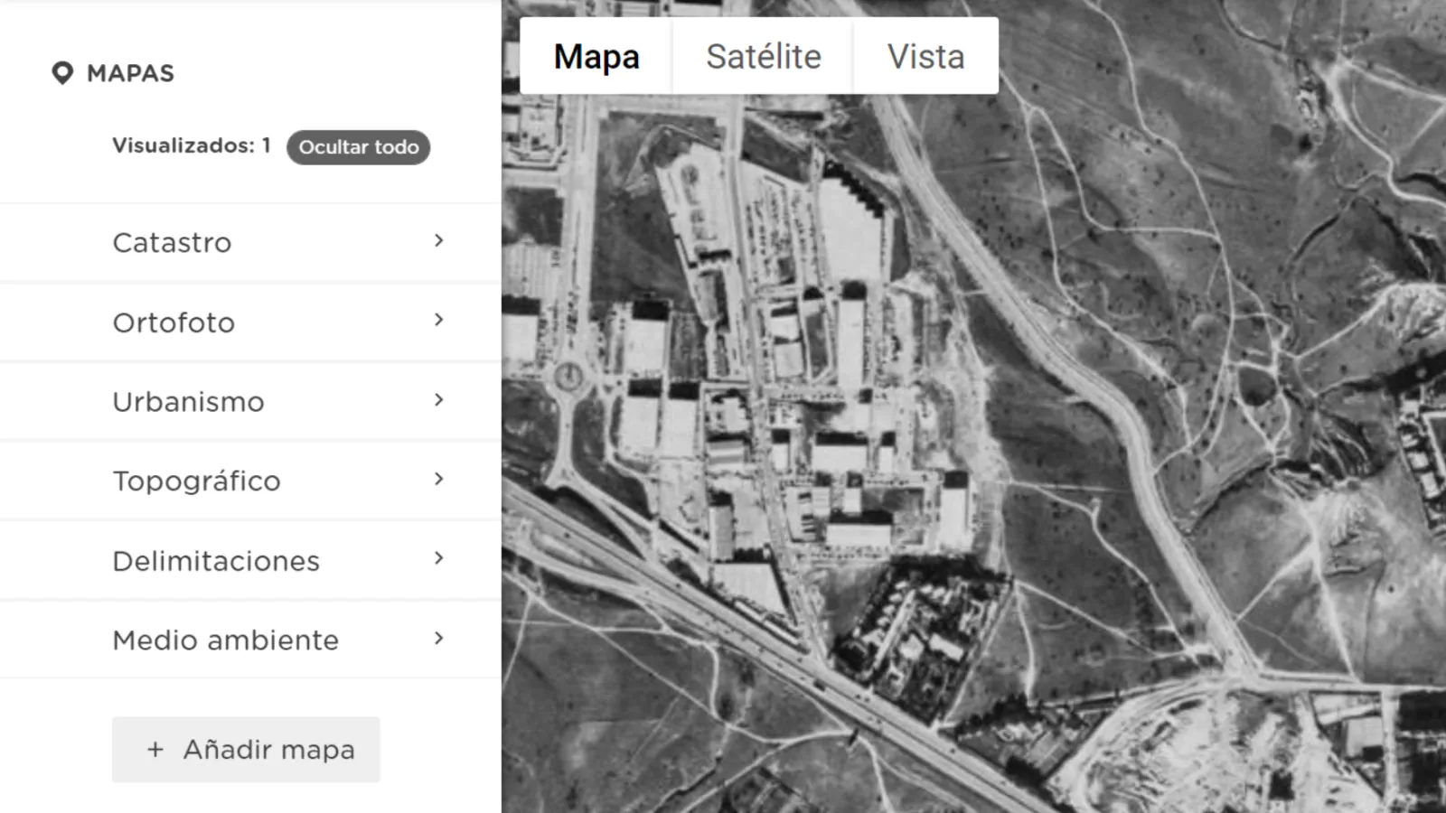
Cadastre, historical orthophotos, topography, urban planning and environment.
How has a piece of land evolved over time? What can be built on it? Does it have any protection? Does it slope? Answer all these questions through thousands of maps.

All the power of Google Maps
High-definition satellite images, oblique images, Street View, geocoding of addresses and shops, list of suggested sites in searches and high speed cartography.
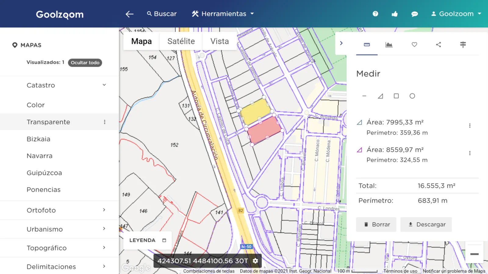
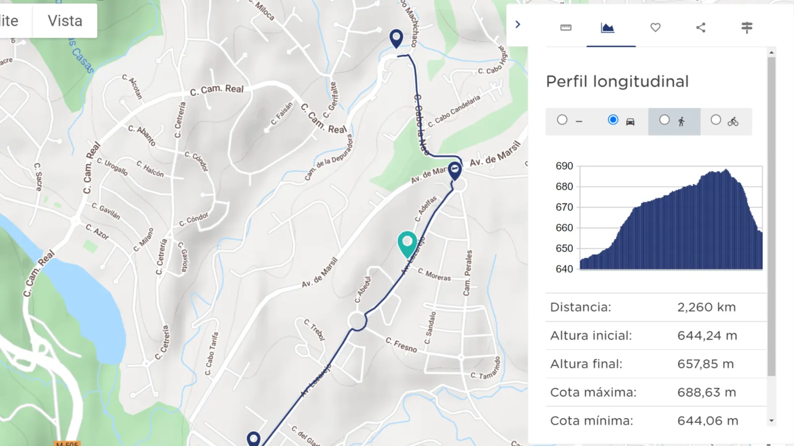
Performs measurements
Measure surfaces on the map, calculate the longitudinal profile and download the data.
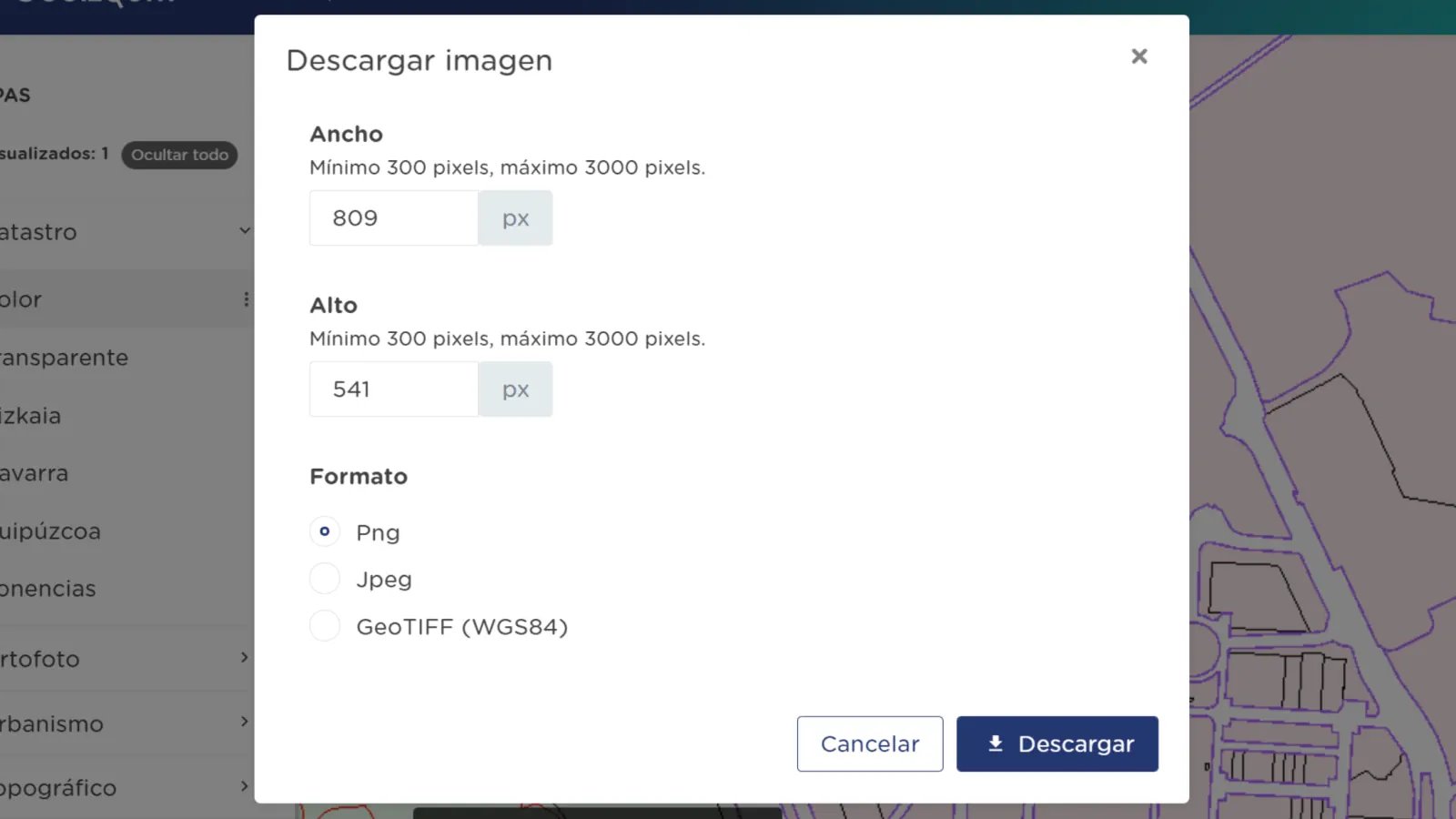
Download all maps
Export in different formats and custom sizes.
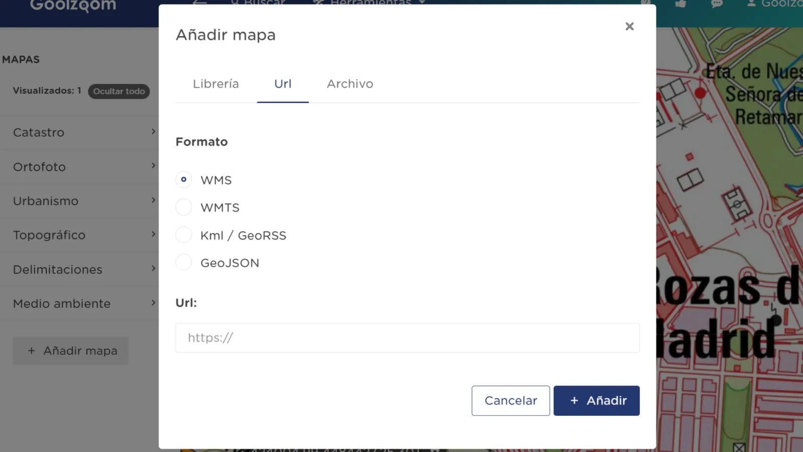
Add your maps
Import Kml, GeoRSS or GeoJSON files, WMS and WMTS services.
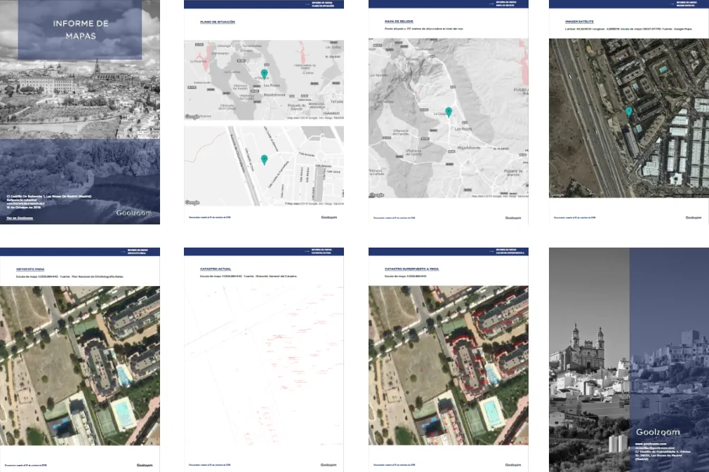
Download reports
In Spanish or English. Map reports, descriptive consultation and historical cadastre.
Start using it completely free of charge
Create your account and access essential tools without any time limit.
Start
+1,500 users registered in the last week