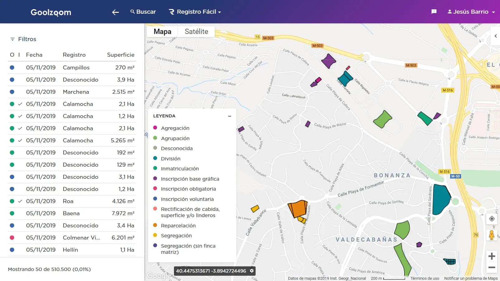
The first tool to display data from Land Registry
Now consulting registry information is as easy as clicking.
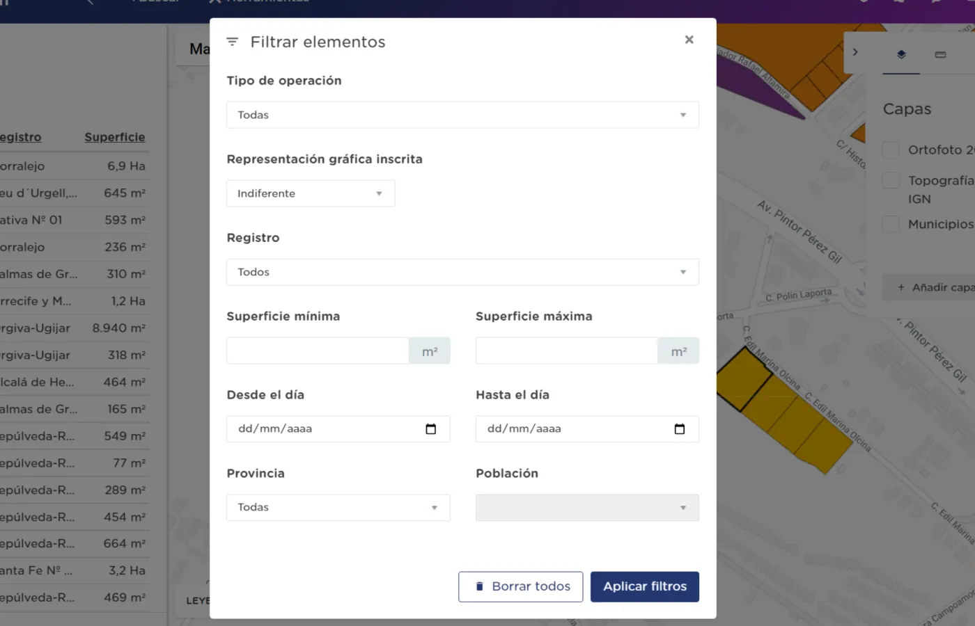
Filter items
By date, municipality, registration, operation and area, etc.
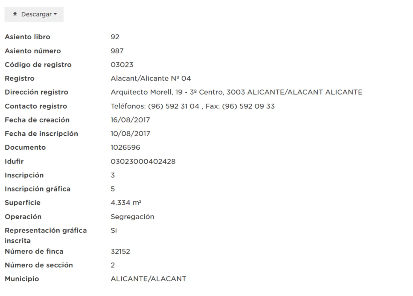
Download data
Geometry and alphanumeric data in different formats.
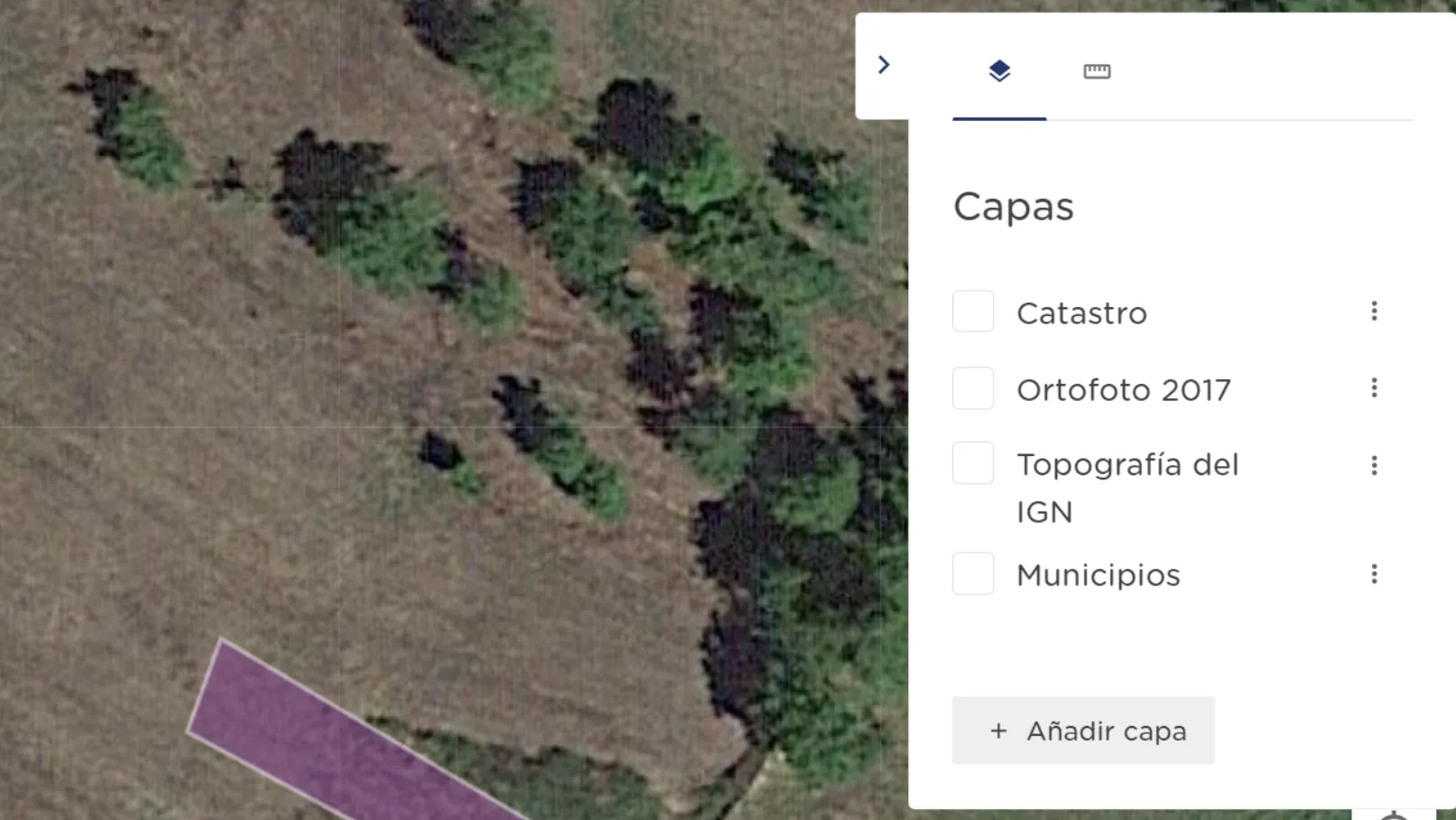
Add other maps
Add other cadastre maps, orthophotos, topography, etc.
Start using it completely free of charge
Create your account and access essential tools without any time limit.
Start
+1,500 users registered in the last week